Perspective Maps
| Annaberg | 1996 | |
| Areál hotelu Solenice | 2000 | |
| Belgie, Holandsko, Lucembursko | 2001 | |
| Bolevecké rybníky | 2004, 1996 | |
| Bolevecké rybníky (AJ, NJ) | 2005 | |
| Centrum města Plzně | 2004 | |
| Holešovická tržnice | 1998 | |
| Hustopeče | 1999 | |
| Kašperské Hory | 1998 | |
| Krásný dvůr | 2010 | |
| Meissen | 1997 | |
| Městský obvod Plzeň 1 | 2002 | |
| Městský obvod Plzeň 2 | 2007, 1997 | |
| Městský obvod Plzeň 3 | 1998 | |
| Městský obvod Plzeň 4 | 2006, 1999 | |
| Mikroregion Manětínsko-nečtinský | 2005 | |
| Mikroregion Měčínsko | 2005 | |
| Mikroregion Radnicko | 2007 | |
| Nádvoří pivovaru Prazdroj | 2005 | |
| NP Šumava a Bavorský les | 2002, 1998 | |
| NP Šumava a Bavorský les (AJ, NJ) | 2002 | |
| Oberlausitzer Bergland | 1995 | |
| Okolí Kašperských Hor | 1998 | |
| Pražšký Hrad | 1999 | |
| Příjezd k zámku Kozel | 1996 | |
| Rund um den Kottmar | 1995 | |
| Sächsische Schweiz | 1993 | |
| Spálené Poříčí | 2007 | |
| Stříbro a okolí | 1998 | |
| Vogtland | 1992 | |
| Vyhlídka "Na horizontu" na Plzeň a okolí | 2008 | |
| Vyškovsko | 2002 | |
| Zámecký park Kozel | 1996 |

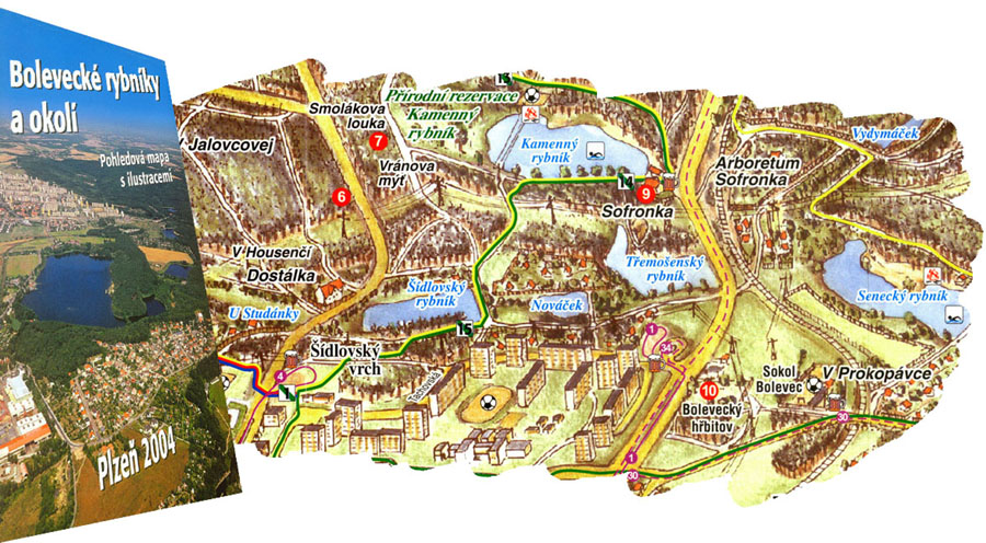
Bolevecké rybníky
The map covers northern part of Plzen. The map was published for the first time in the year 1996 and updated in 2004. A range of the map is determined by villages Chotikov, Ledce, Tremosna, Zruc, and Plzen in the south. Points of interest of this area are described in the map. Pictures are attached as well.

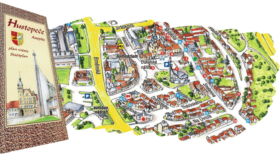
Hustopeče
The map covers the city of Hustopece. It was published in the year 1999. A range of the map matches the built-up part of the city. The map is supplemented with pictures of historical sights of the city.

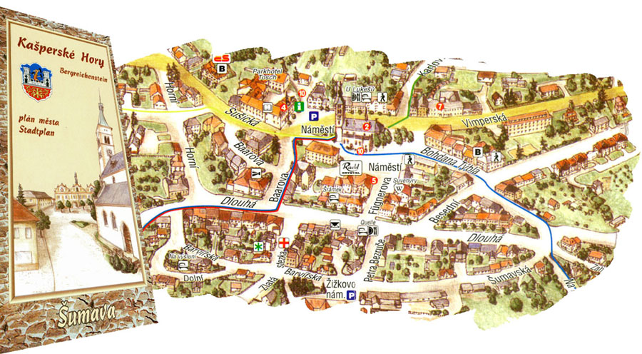
Kašperské Hory
The map shows the town of Kasperske Hory. It was published in the year 1998. A range of the map corresponds to built-up part of the city. The map is supplemented with information on attractions and accommodation possibilities in the town.

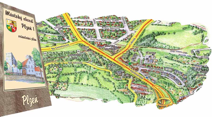
Městský obvod Plzeň 1
The map covers a northern part of Plzen. It was published in the year 2002. A range of the map corresponds to built-up part of the district. This map includes also a recreation area of Bolevec Ponds and surroundings (Bolevecke rybniky a okoli). This region is also shown in the special map Bolevecke rybniky a okoli (see above). Important contacts and information on the district itself and its points of interest are included. Pictures are attached as well.

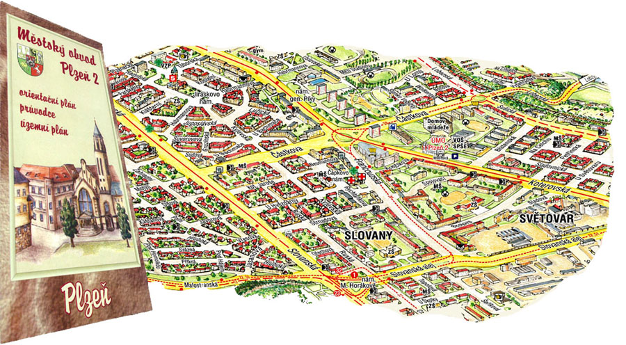
Městský obvod Plzeň 2
The map was published for the first time in the year 1997 and the second edition is to be published in 2007. The map covers an area of the Plzen 2 District which is situated in the south-eastern part of the city. There is information on this district with its characteristic and history on the backside of the map.

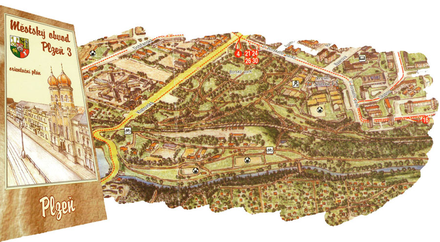
Městský obvod Plzeň 3
The map shows a southern part of Plzen. It was published in 1998. A range of the map corresponds to the Plzen 3 District. There is information on the history of Plzen 3 District and contacts to important institutions on the backside.

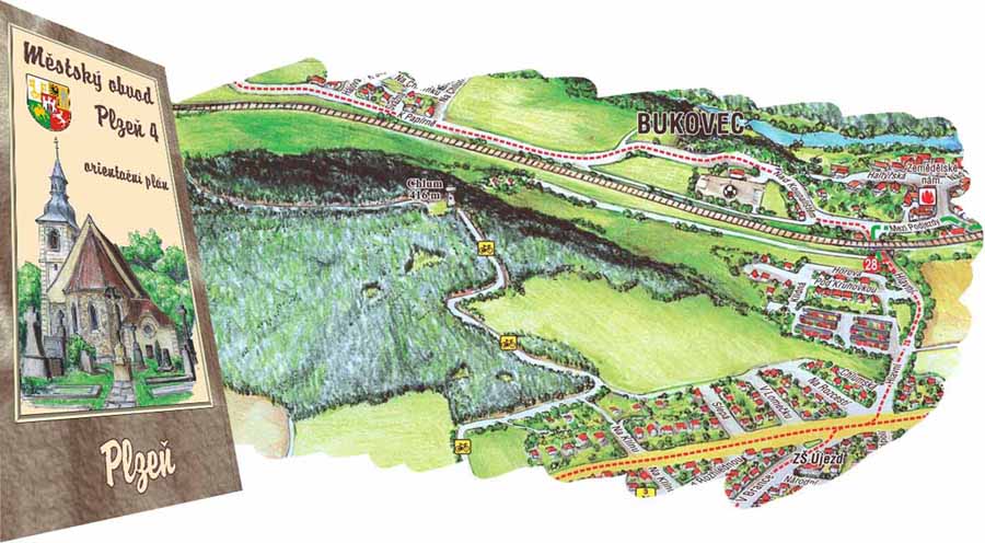
Městský obvod Plzeň 4
The map was published for the first time in 1999. The second edition was published in 2006. The map covers an area of the Plzen 4 District which is situated in the north-eastern part of the city. Important contacts associated with the district are included. A text attachement with characteristic and history of this district comes along.

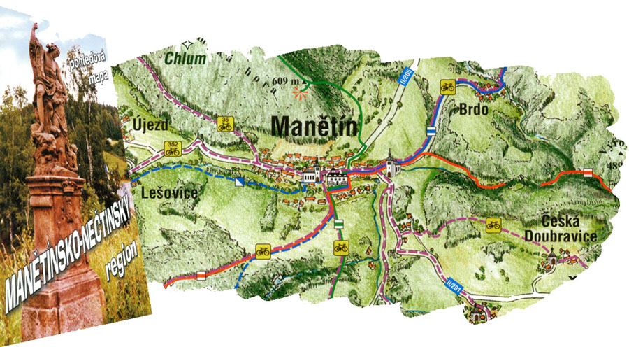
Mikroregion Manětínsko-nečtinský
Manetin-Nectiny region includes urban areas of Manetin, Nectiny and Stichovice. The map of 2005 covers an area bordered by Bezverov in the west, by Rabstejn and the Strela river in the east, by Psov in the north, and by Stipoklasy in the south. You can find information on villages and towns of this micro-region on the backside of the map.

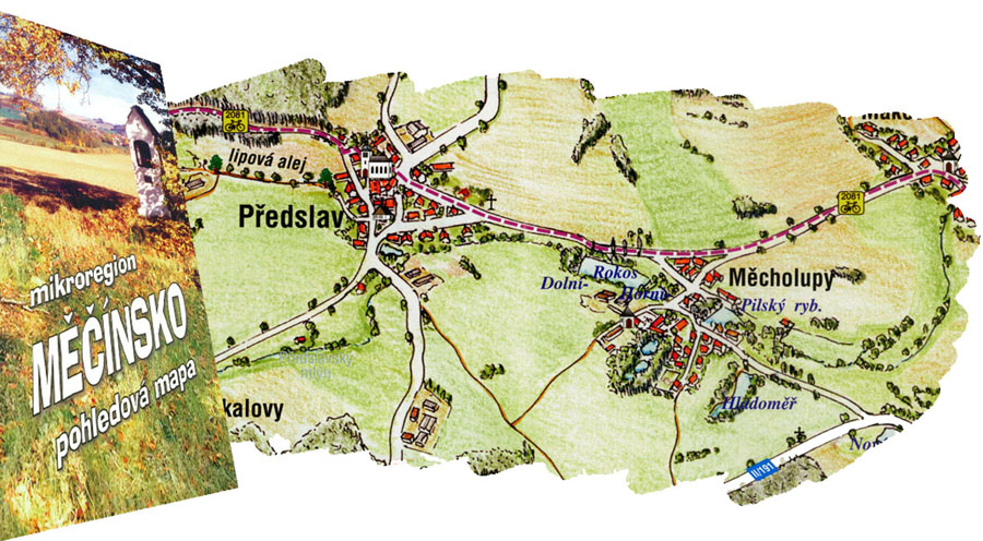
Mikroregion Měčínsko
The map, published in 2005, shows a surrounding of Mecin. The map covers an area bordered by Otin in the west, by Radochovy in the east, by Tyniste in the north, and by Zbyslav in the south. Information on neighbouring villages can be found on the backside of the map.

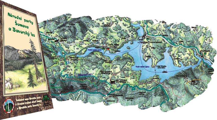
NP Šumava a Bavorský les
An unique perspective map of the Sumava and Bavorsky les National Park covers the area from Nyrsko to the Lipno dam. You can find interesting articles and pictures on this map too. The second edition was published in the year 2002, the first one in 1998.

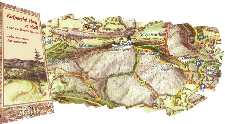
Okolí Kašperských Hor
The map of 1998 covers a surrounding of Kasperske Hory. The map shows an area bordered by Rejstejn in the west, by Strasin in the east, by Dlouha Ves in the north, and by Zhuri in the south. Information on neighbouring villages can be found on the backside of the map.

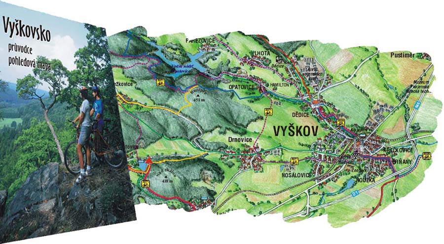
Vyškovsko
A perspective map of Vyskov and its surrounding. The map is supplemented by many photos of points of interest from Vyskov region. The map was published in 2002.

