Traveller's Maps
Maps in magazines
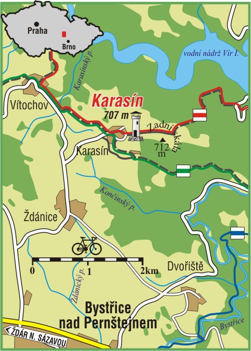
 The goal of accompanying maps to the articles is to clearly and transparently illustrate the journey or region which is described in the stories of travellers.
Such a map enables reader to imagine where the described story took place.
The goal of accompanying maps to the articles is to clearly and transparently illustrate the journey or region which is described in the stories of travellers.
Such a map enables reader to imagine where the described story took place.
 It does not matter whether it was in the Czech Republic,
elsewhere in Europe,
or far overseas. Our maps illustrate interesting stories of travellers.
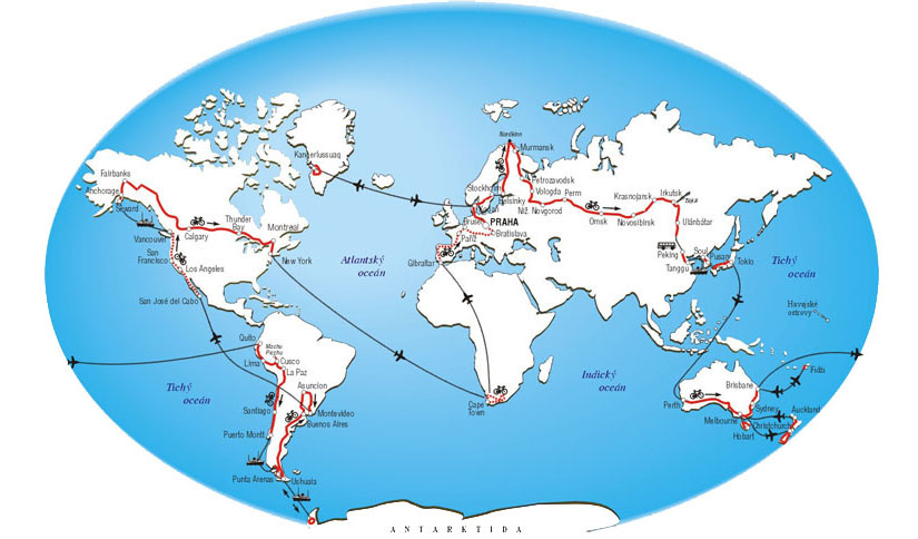
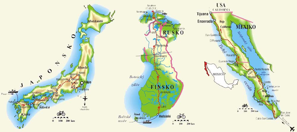
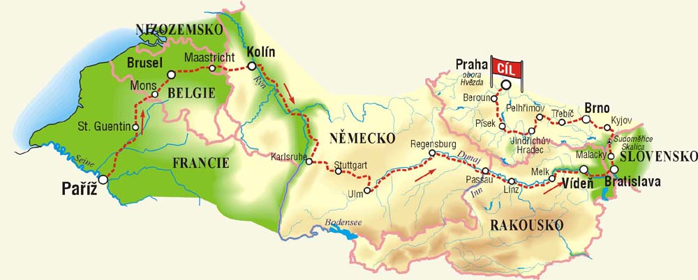
In the beginning, RAMAP drew maps for the Cykloturistika magazine. We started with the simple visualization of Víťa Dostál's World tour,
as well as more complicated maps of a trip through Iceland by Lucka and Michal, and other maps of Scandinavia.
During the years, we created even a few continuous series. We produce series of maps with unified design, e.g.
The Outlook Towers in the Czech Republic, The Trolls´ Track, The Castles and the Ruins,
The Windmills and The Alpine Passes. Some of them appear in magazines also nowadays.
It does not matter whether it was in the Czech Republic,
elsewhere in Europe,
or far overseas. Our maps illustrate interesting stories of travellers.
In the beginning, RAMAP drew maps for the Cykloturistika magazine. We started with the simple visualization of Víťa Dostál's World tour,
as well as more complicated maps of a trip through Iceland by Lucka and Michal, and other maps of Scandinavia.
During the years, we created even a few continuous series. We produce series of maps with unified design, e.g.
The Outlook Towers in the Czech Republic, The Trolls´ Track, The Castles and the Ruins,
The Windmills and The Alpine Passes. Some of them appear in magazines also nowadays.
Maps in books
This type of maps appears also in cycling-focused books. The most detailed is the narration of Lucka Kovaříková and Michal Jon which describes their 3-year World tour. Their travelling is described in four books called: :- Z Čech až do Země vycházejícího slunce
- Pod oblohou Jižního kříže
- Přes ledové království do Zeleného pekla
- Od vlků a slonů ... Hurá domů
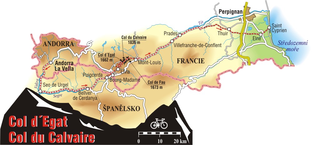 Another map sample comes from the journey across alpine passes carried out by Michal Třetina.
Knižně se zrealizoval i soubor vysokohorských výšlapů do nejvyšších a nejkrásnějších alpských průsmyků Michala Třetiny
Another map sample comes from the journey across alpine passes carried out by Michal Třetina.
Knižně se zrealizoval i soubor vysokohorských výšlapů do nejvyšších a nejkrásnějších alpských průsmyků Michala Třetiny
Jak se jezdí do nebe, that accompanied a significant portion of the magazine Cycling.
Another peculiar journey of Jan Vlasak in titles: Pestrý život cyklotrempa, Vandry s bi(ej)kem, or cycling guide of Norway by Radek Kunc (Cestami Trollů).

